A desktop app with its own map engine: 3D terrain, a globe view, terrain tools and ZYRNTOPO's maps, offline, on the same account and data as the phone app.
A working copy of the ZYRN Workstation window, running in your browser. The Map tab tools and the search box work: try Camp Muir, Nisqually Glacier, 46.85, -121.76 or 10T ES 94815 89385.
On the desk
Room to plan a search and brief a team.
ZYRN Workstation fills a full screen: a ribbon of tools grouped by task, the map in 2D or 3D, and a status bar that always shows where the cursor is in latitude and longitude, UTM and MGRS.
It uses the same account, saved items and file formats as ZYRNTOPO in the field, so the plan made at the desk is the plan the teams carry.
- 3D terrain and a globe view
- Toolbars for search and rescue, range and bearing, and terrain
- Import, export and print true-scale map sheets
- Team Sync and TAK on the same map Pro
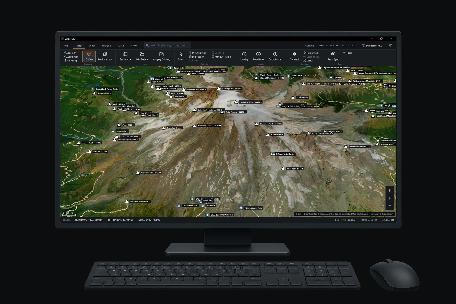
The ribbon
Tools grouped by the job you're doing.
Each tab holds the tools for one part of the work.
- Map
Zoom, north up, the 3D view, bookmarks, basemaps, added data, the imagery catalog, and select and identify tools.
Navigate, Layer, Selection, Inquiry - GPS and Team
Connect a GPS receiver, replay a log, and run Team Sync and TAK links from one place.
Receiver, Team - Draw
Markers, lines, areas and measurements on the map, saved as ordinary map items.
Create, Edit - Range and Bearing
Range rings, bearing lines and distances from any point, in the units the team uses.
Range, Bearing - Search and Rescue
Search areas, segments, team assignments and the clue log for each shift.
Plan, Assign, Log - Analysis
What's visible from a point, line of sight, elevation profiles and slope.
Terrain - Data
Import and export common file formats, browse the data in a table and print maps.
Import, Export, Print - UAS
Drones and other MAVLink vehicles on the map, with in-app video. Pro Beta
Vehicle, Video
System requirements
What ZYRN Workstation needs to run.
One command installs it, checks the download against its published SHA-256 and stops on any mismatch. Run it again to update.
| Platform | Operating system | Graphics | Packages | Status |
|---|---|---|---|---|
| Windows | Windows 10 or 11, 64-bit. ARM64 PCs run the x64 build under emulation | OpenGL 4.1 | Per-user installer, per-machine .msi for Group Policy or Intune | Available |
| Linux | 64-bit x86 with glibc 2.35 or newer: Ubuntu 22.04, Debian 12, Fedora 36, Linux Mint 21, Arch and later | OpenGL 4.1 driver | .deb, .rpm, pacman, or an AppImage that needs no root | Available |
| macOS | Planned | – | – | Planned |
Windows, in PowerShell
irm https://zyrntopo.com/zyrngis.ps1 | iexLinux, in a terminal
curl -fsSL https://zyrntopo.com/zyrngis.sh | shPlan at the desk, then take it into the field.
ZYRN Workstation and ZYRNTOPO share one account and one Pro license.